Methane detection from satellite imagery
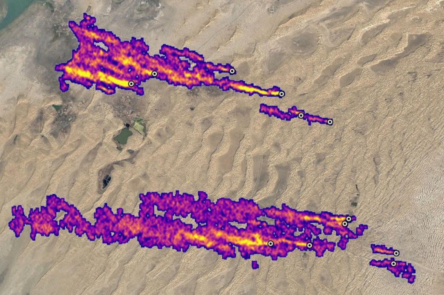
UK Space Agency-funded research into detecting methane plumes in Sentinel-2 imagery, tested on more than 20 oil and gas and landfill sites on four continents. It works best on large point sources over desert.
Employer: Sparkgeo (funded by the UK Space Agency)
When: 2023
Data: Sentinel-2, Sentinel-3, Sentinel-5P, EMIT (Earth Surface Mineral Dust Source Investigation), GHGSat
Methods: Multi-band single-pass and multi-pass methane retrieval (Varon et al., 2021), change detection, empirical thresholding
Stack: Python, Xarray, Rasterio, STAC, Element 84 Earth Search
Background
In 2023 Sparkgeo’s UK team won UK Space Agency funding to develop a methane emissions alert service. Users such as infrastructure operators, regulators and environmental groups would register the sites they want monitored. The service would then check the latest satellite imagery over them for signs of methane and alert users to significant changes.
Methane is a potent greenhouse gas, and a small number of large leaks from oil and gas infrastructure account for a large share of emissions. Sentinel-2 wasn’t designed to measure methane, but its two shortwave infrared bands react differently to the gas, so large plumes can be detected in its free 20 m imagery, which covers the globe every few days. This project tested how well that detection works in practice.
My contribution
I owned the research and did the technical work, with project management and feedback from the wider team.
- Built a plume detection workflow based on Varon et al. (2021). Methane absorbs strongly in Sentinel-2’s band 12 (~2190 nm) and weakly in band 11 (~1610 nm), so a plume shows up as a dip in band 12 relative to band 11.
- Implemented and compared both variants of the method:
- Single-pass compares the two bands within one image.
- Multi-pass also subtracts the same comparison from a plume-free reference image of the same site, removing surface features that can mimic methane.
- Flagged plumes with empirical thresholds, and built time series of plume detections over individual sites.
- Found known plumes to test against using NASA EMIT and GHGSat detections, then tested the workflow on more than 20 oil and gas and landfill sites in Turkmenistan, Algeria, Texas, Alberta and the UK, and on the 2022 Nord Stream pipeline leak.
- Explored complementary datasets: Sentinel-3 for daily revisits at moderate resolution, and Sentinel-5P for regional hotspots at coarse resolution.
- Investigated sensors and workflows for future project development.
Outcome
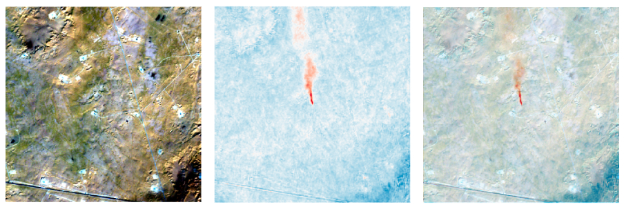
- The multi-pass method worked better than the single-pass method.
- Detection worked best over desert sites, with bright, uniform surfaces. It struggled over water, which reflects little shortwave infrared light: even the very large Nord Stream leak wasn’t detected well.
- Only large point sources such as major gas well leaks were reliably detected. Diffuse sources such as landfills were not.
- The proof of concept stopped at detection: emission rates weren’t estimated.
- Planned next steps: replace empirical thresholding with machine learning for plume detection, and quantify methane emission rates.