Mapping agricultural drought in Alberta
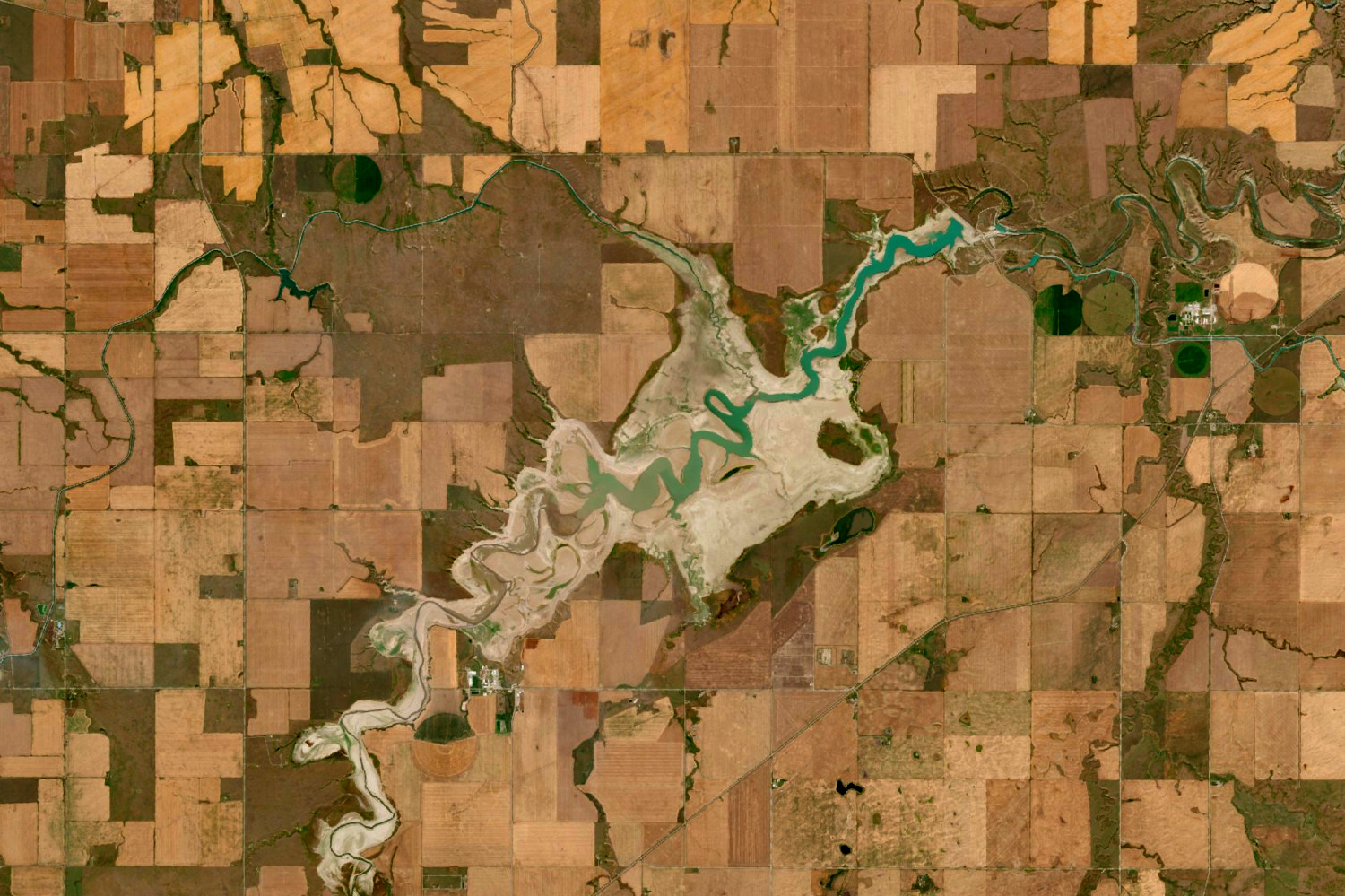
Mapping Alberta’s 2021 and 2023 agricultural droughts with NDVI time series, from province-wide MODIS to daily Planet Fusion data over selected areas, where irrigation largely offset the drought. Published as a two-part blog series.
Employer: Sparkgeo (internal project)
When: 2023
Data: PlanetScope (Planet Fusion Monitoring), MODIS
Methods: NDVI time series, multi-temporal change analysis
Stack: Python, Xarray, Rasterio, Plotly, Streamlit, Cloud Optimized GeoTIFF (COG), Mapbox, JavaScript
Background
This project used satellite imagery to examine the droughts of 2021 and 2023 in Alberta, both of which were visible in the data. We explored the drought impact using multi-temporal NDVI analysis and visualizations. The project began as an internal demo of Planet Fusion Monitoring, but its main outcome was the drought mapping.
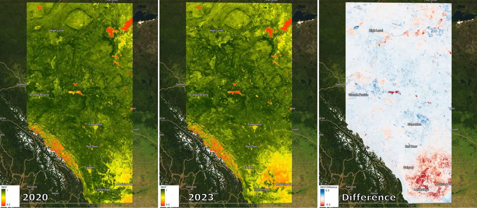
The analysis occurred in two parts, which were presented in two different blog posts. In the first part, low-resolution MODIS data were used to compare NDVI across the entire province over a six-year period, with inter-annual differences displayed in a web map.
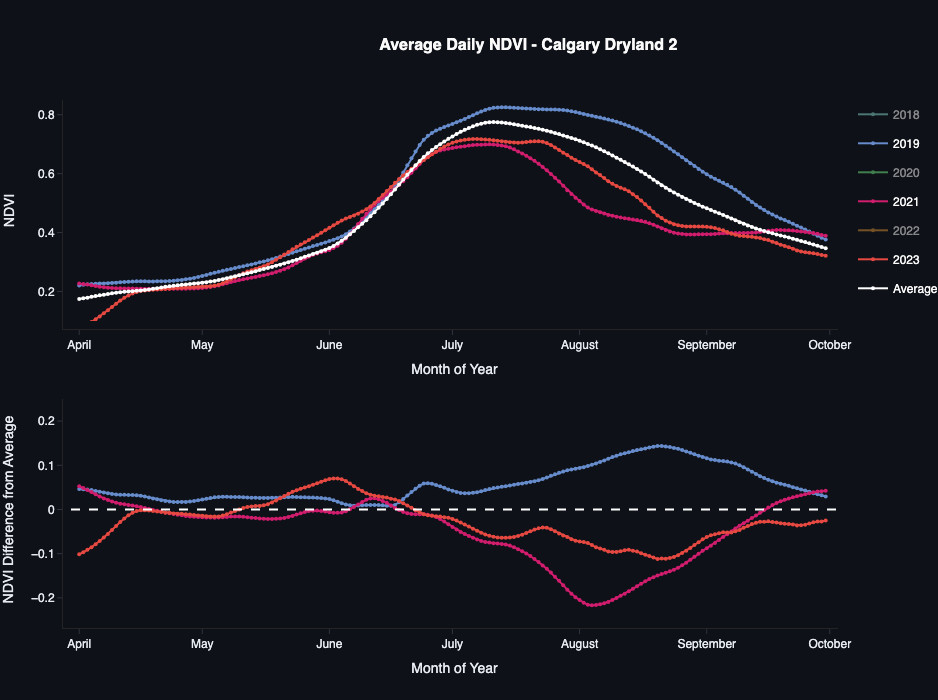
The second part of the project used Planet Fusion Monitoring, an analysis-ready data product from Planet. For this stage, areas of interest (AOIs) across Alberta agricultural zones were selected, and Planet Fusion data was used to produce daily NDVI time series plots and animated visualizations. An interactive dashboard was created to explore the results, allowing users to switch between the AOIs and compare the time series plots and animations for each.
My contribution
- Developed a workflow to retrieve and process MODIS and Planet Fusion datasets into NDVI time series and change layers.
- Produced an interactive web map to compare inter-annual MODIS NDVI data.
- Produced a dashboard and interactive visualizations for the Planet Fusion Monitoring blog.
- Wrote, edited and published both blog posts.
Outcome
- Analysis from this work demonstrated the utility of satellite image data for mapping drought conditions, and particularly the ability of Planet Fusion to produce smooth, gap-free daily time series to help illustrate the impact.
- Drought impacts were worst in 2021 and 2023, as expected, but their extent varied across the province, and irrigation largely mitigated the impact.
- Results presented in a two-part blog series, with the interactive web map and dashboard embedded in the posts. The dashboard is no longer online.