Mapping the 2021 Sumas Prairie flood
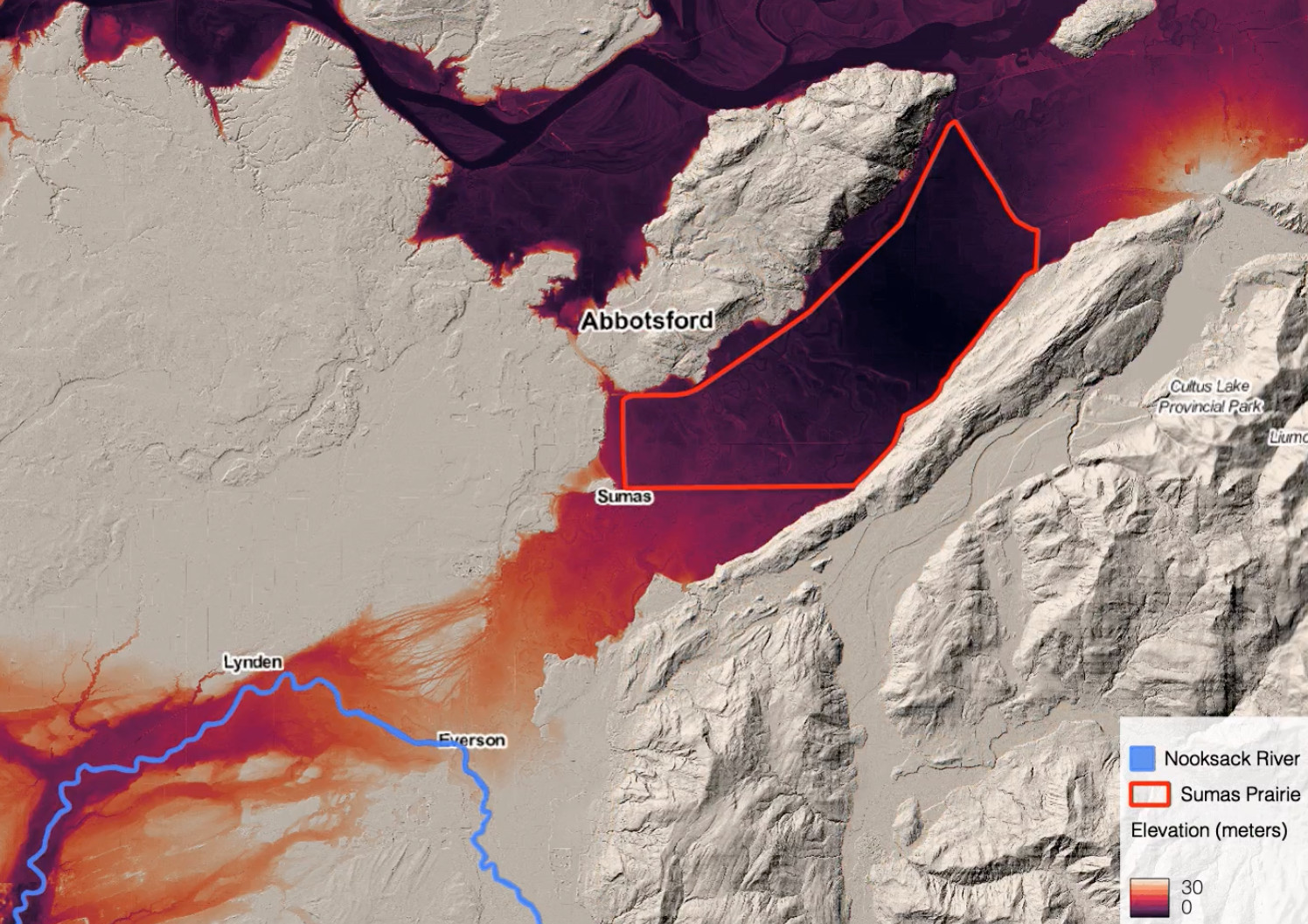
Mapping the November 2021 flooding around Abbotsford, BC with Sentinel-1 radar change detection, then using lidar elevation data to explain where the water went and why. Published as a two-part blog series.
Employer: Sparkgeo (internal project)
When: 2021
Data: Sentinel-1 SAR (Ground Range Detected), Sentinel-2, lidar digital elevation models (DEMs) for Abbotsford and northern Washington, City of Abbotsford dike breach map
Methods: SAR change detection, topographic analysis, Topographic Wetness Index (TWI)
Stack: Python, Xarray, Rasterio, QGIS
Background
On November 14, 2021, an atmospheric river brought record rainfall to southern British Columbia. Abbotsford received 150 mm in two days, and the Sumas Prairie, a farming area on the bed of the former Sumas Lake, flooded. Cloud cover hid the area from optical satellites such as Sentinel-2 and Landsat-8 after the flood, so we used radar, which sees through cloud.
The project had two parts, each published as a blog post. The first mapped the flooding from Sentinel-1 radar images. The second went beyond mapping where the flooding occurred to explain it, using lidar elevation data and a Topographic Wetness Index (TWI), which models where water is likely to collect.
My contribution
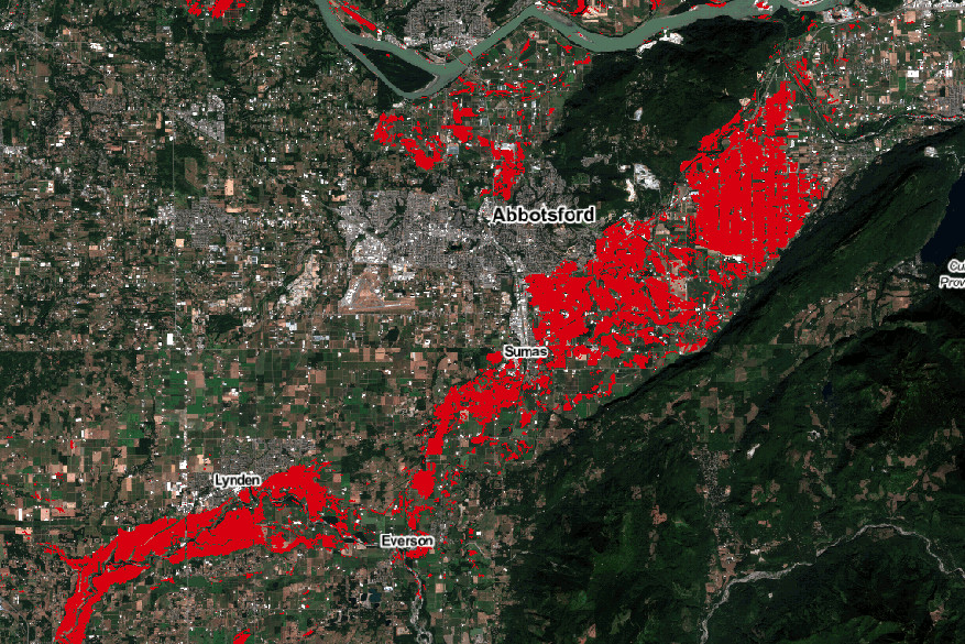
- Developed the flood mapping method: change detection on two before/after pairs of Sentinel-1 images (November 4/16 and November 13/20) to find surface water that wasn’t there before the flood.
- Analyzed the lidar elevation data to trace flow paths from the Nooksack River into the Sumas Prairie, and compared the flood maps with the DEM and TWI. A colleague produced the TWI.
- Digitized the dike breach locations from a City of Abbotsford map and compared them with the elevation data and flooding.
- Wrote both blog posts. The first is published under the Sparkgeo Team byline.
Outcome
- The flood maps showed a path of flooding from the Nooksack River in Washington north-east into the Sumas Prairie, supporting reports that the Nooksack was the main source. They also showed separate flooding on the Fraser River floodplain north of Abbotsford.
- The change detection picked up the flood water while avoiding other dark surfaces in radar images, such as Abbotsford airport and Cultus Lake.
- Comparing the two dates showed how quickly the flood moved: after the Sumas Dike failed in two places, water flowed into the previously dry north-east of the prairie.
- Areas with a high TWI matched the flooding between the Nooksack and the prairie, and north of Abbotsford, and were high near both dike failures. Within the prairie, the land below 3 m elevation matched the November 20 flooding and roughly traced the outline of the old lake. The TWI matched it less well, likely because the index was designed for natural watersheds, not drained and actively managed land.
- Limitation: Sentinel-1 images an area roughly every 2–4 days, which may be too slow for fast-moving floods; newer commercial radar satellites promise daily revisits or better.